
DGNSS receiver with IMU tilt
SurveyPod V1 Tilt DGNSS receiver
Measure the point without levelling the pole. Lean it up to 60° and record.
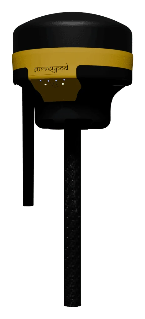
- 60°
- tilt, in any direction
- 1 cm
- tilt accuracy up to 30°
- 1 s
- initialisation
- 0
- bubbles to centre
What it is
With an ordinary receiver, every point starts with centring a bubble. SurveyPod V1 Tilt adds an inertial measurement unit that knows the angle and direction of the pole, and corrects the position of the tip automatically. You place the tip, lean the pole wherever is convenient, and record.
Where tilt pays off
Faster on every point
No pause to level the pole. Over hundreds of points a day the saving is substantial.
Corners and walls
Reach building corners, fence lines and kerbs where a vertical pole cannot stand.
Slopes and rough ground
Stay balanced on embankments and uneven terrain instead of fighting the bubble.
Less fatigue
Fewer adjustments mean less strain over a long field day.
How tilt compensation works
The receiver knows where its antenna is. The IMU tells it how the pole is leaning. From those two facts it works out where the tip of the pole touches the ground, which is the point you actually want.
Standard or tilt?
| SurveyPod V1 | SurveyPod V1 Tilt | |
|---|---|---|
| Pole must be vertical | Yes | No |
| Bubble levelling | Needed at every point | Not needed |
| Points near walls and fences | Difficult | Reached by leaning the pole |
| Speed per point | Standard | Faster |
| Tilt compensation | No | IMU, up to 60° |
Specifications
Tilt compensation
- Sensor
- Inertial measurement unit (IMU)
- Tilt angle
- Up to 60° in any direction
- Tilt accuracy
- 1 cm up to 30°, up to 5 cm at 60°
- Initialisation time
- 1 second (95%)
Positioning
- Modes
- RTK, PPK, static
- Constellations
- GPS, GLONASS, Galileo, BeiDou
- Corrections
- Radio, internet, CORS
Manufacturer’s published specifications, subject to change. For signals, connectivity, battery and dimensions see the SurveyPod V1.
Questions about the SurveyPod V1 Tilt
Used for
What is tilt compensation in a GNSS receiver?
An IMU inside the receiver measures how far and in which direction the pole is leaning, and the software calculates the true position of the pole tip. You do not need to hold the pole vertical.
How far can the pole be tilted?
Up to 60° in any direction. Accuracy is best at smaller angles: about 1 cm up to 30°.
Is tilt worth it over the standard SurveyPod V1?
If you collect many points daily or often work near walls, fences and slopes, yes. For occasional control points on open ground the standard V1 does the job.
Does the IMU need calibration every time?
Initialisation takes about a second in normal use, after which you can survey with the pole tilted.
Have a project in the air?
Send us the site location and what you need to know about it. We will reply with scope, timeline and a quote.
- WhatsApp: +91 99091 00410
- Phone: +91 99091 00410
- Email: info@megatronixvision.com