
Large-area survey and surveillance drone
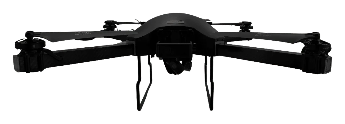
Surveyaan V1RC Plus survey drone
Long endurance, swappable payloads: one aircraft for large surveys and live aerial monitoring.
- 40–45 min
- endurance
- 1 sq km
- per flight, up to
- < 5 cm
- X/Y accuracy with GCP
- 3
- payload options
What it is
The V1RC Plus is the workhorse of the Surveyaan range. It stays up for 40 to 45 minutes, covers up to a square kilometre in one flight, and takes three different payloads. Fit the PPK camera for accurate mapping with fewer ground control points, or the stabilised video payload when you need a live view of a site.
Three payloads, one airframe
Standard camera
23 MP camera with a 1/2.3-inch sensor for routine photogrammetry. Also records 5.3K video.
PPK RGB camera
20 MP APS-C sensor paired with an L1/L2 GNSS receiver logging at up to 10 Hz. Delivers under 5 cm horizontal accuracy without dense ground control.
Surveillance payload
2K video on a 3-axis stabilised gimbal with a live 720p feed, for site monitoring, security and inspection.
Built for daily commercial use
Layered failsafes
Dual processors and sensors, with automatic return to home on low battery, high wind, GPS trouble or loss of link.
Rated for 3,000 cycles
A carbon fibre frame designed for thousands of mapping flights.
Joystick controller with live view
A hard joystick controller with real-time FPV video and flight information out to 2.5 km.
Portable
The package weighs under 5 kg and is ready to fly in about five minutes.
Specifications
Aircraft
- Type
- Quad-rotor
- Category
- Small
- Weight with payload
- 2.65 kg
- Airframe
- Carbon fibre, rated for 3,000 cycles
- Compliance
- DGCA compliant
Flight
- Endurance
- 40–45 minutes
- Range
- 2.5 km
- Maximum altitude
- 120 m
- Wind resistance
- Up to 25 km/h
- Missions
- Autonomous waypoint flights
Survey
- Coverage
- Up to 1 sq km per flight
- Accuracy with GCP
- Under 5 cm X/Y, under 10 cm Z
- Outputs
- Orthomosaic, DSM, DTM, point cloud, 3D model, DXF/DWG contours
Payloads
- Standard
- 23 MP, 1/2.3-inch sensor, 5.3K video
- PPK RGB
- 20 MP APS-C, L1/L2 GNSS, up to 10 Hz
- Surveillance
- 2K video, 3-axis gimbal, live 720p
Control
- Controller
- Hard joystick
- Video
- Real-time FPV feed
- Setup time
- About 5 minutes
- Package weight
- Under 5 kg
Manufacturer’s published specifications, subject to change.
Questions about the Surveyaan V1RC Plus
Used for
What is the difference between the V1 and the V1RC Plus?
The V1RC Plus flies longer (40–45 minutes against 25–30), reaches further, supports PPK for higher accuracy and can carry a surveillance camera. The V1 is lighter, simpler and sits in the micro category.
What does PPK mean for my survey?
PPK corrects each photo position after the flight using GNSS data. You need far fewer ground control points to reach survey accuracy, which saves field time on large sites.
Can the V1RC Plus be used for security monitoring?
Yes. With the surveillance payload it sends stabilised live video to the controller, which suits construction sites, mines, large campuses and public events.
What happens if the link or GPS is lost?
The drone returns to its home point automatically on low battery, high wind, GPS faults or loss of communication.
Which deliverables can I produce?
Orthomosaic maps, surface and terrain models, point clouds, 3D models and CAD contours in DXF or DWG.
Have a project in the air?
Send us the site location and what you need to know about it. We will reply with scope, timeline and a quote.
- WhatsApp: +91 99091 00410
- Phone: +91 99091 00410
- Email: info@megatronixvision.com